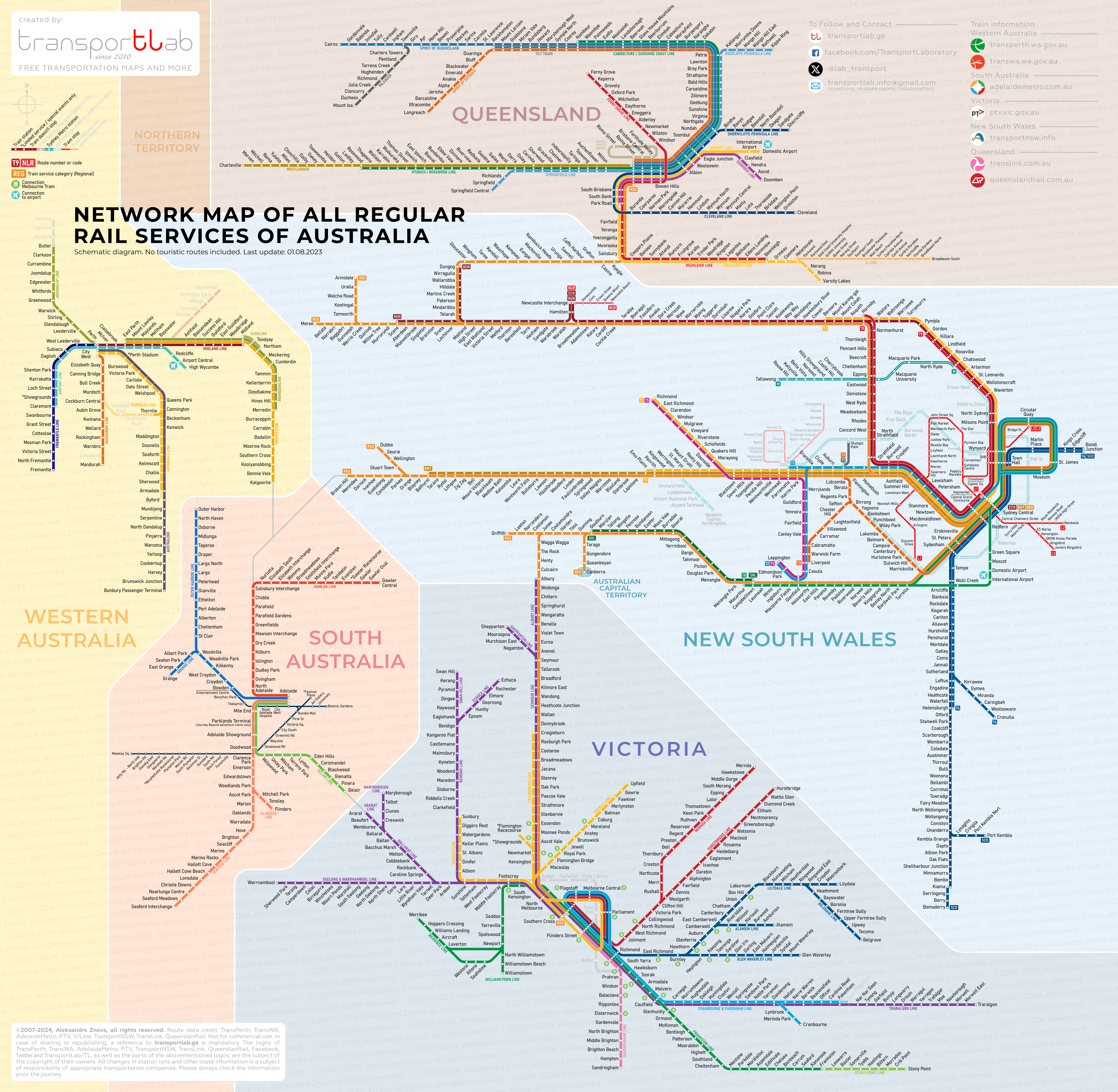
Before the passenger rail map of Australia began to look like what you can see now, I had to make some compromises with my own idea how it must look. At first I decided to show only regional and InterCity trains, but soon I realized that many suburban trains cover quite big areas and must be present too. Then I decided to put even the tram lines (except Melnbourne). The next problem was to deal with a geographical map. Some segments of the routes had to be laid on their side. I hope it does not interfere with the readability of the map. Ok, now you can download it for personal use.
Desktop: click on the image, then right-click for options. Mobile device: tap on image for further zoom-in/zoom-out, tap and hold to choose to open full resolution image on the new tab.
Image credit: Gareth Edwards


