Daugavpils is the second biggest city in Latvia which is around 230 km east of the country’s capital. The population reaches almost 90.000 but with suburbs, it could be up to 112.000. Let’s look at what the transportation authorities are offering their inhabitants and tourists of this city.
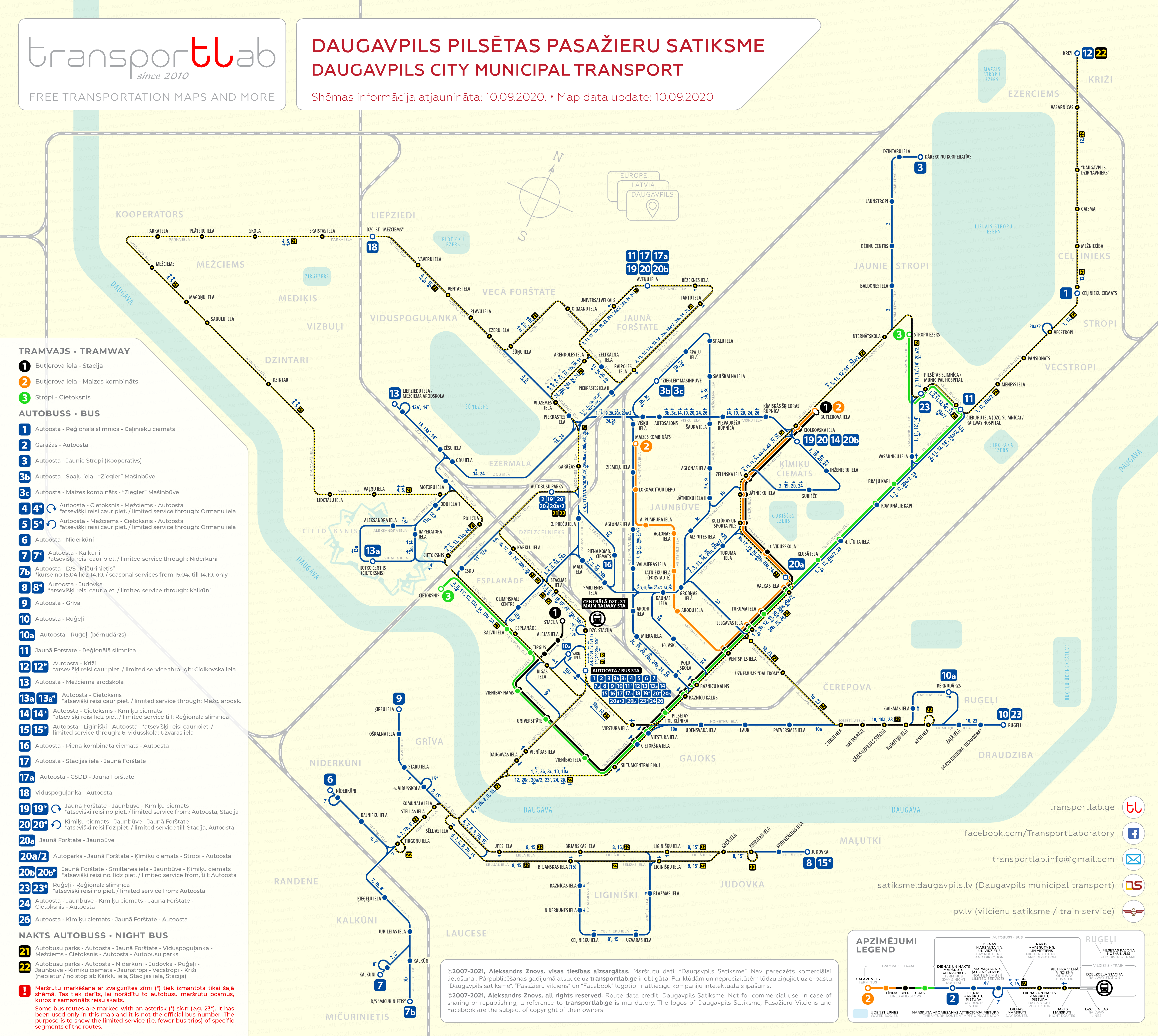
The transport system of the city of Daugavpils consists of two types of transportation – tramway and bus. Both systems are integrated into each other and has unified ticket tariff. While the tramway has 3 lines, bus traffic has 26 routes, two of which are for night services. Despite the conveniently located railway track network, the authorities didn’t realize to use such benefits for the rapid transit within the city and suburbs.
When I was starting to explore the official website of Daugavpils transport company, firstly all look quite smooth unless I tried to understand what actually all 26 bus routes are going to offer. Oh boy, that was the real challenge to understand how and why the routes are so confusing that I had to spend a couple of days at the computer to get the approximate view of what is going on.
Most bus routes are starting their way from [what a surprise] the bus station, which is the typical way how the traffic in the Soviet Union was organized. The lines are doubling each other in multiple sections and almost completely doubling tram lines which raise many questions regarding the efficiency of the transport system. Some routes doubling even the most route length. Some routes have only one trip per day, but for some reason, each has its own number. Who knows maybe inhabitants are happy with it and maybe city major is on the way to make big changes, but as by now we have what we have.
Well, frankly speaking, this whole situation is for me like a kind of delicious dessert, so I will definitely return to the topic of optimizing the transport system of this city in the near future and I will offer my vision. Now let’s get back to the real situation and see what the transport system of this interesting city is looking like. The bus traffic net is very complicated, but I hope it will hope the scheme created by me will help you to understand what these 26 bus routes are staying for.
This network map is for non-commercial use only! To view or download a high-resolution map please click on the image below, then right-click and choose the action.


