The new year has already arrived, and the work on the municipal transport diagram of Kryvyi Rih has not yet been completed. I hasten to assure you that I am almost touching the finish tape – the information is being checked and corrected, so please be patient, and you will see the new scheme very soon, thanks. Meanwhile, I ask you to take a look at my vision of how the passenger transit can be organized within the city and beyond using rail transport based on existing railway infrastructure. I sketched a simple diagram when I started working on a real municipal transport map after finding out the real situation. Let’s go?
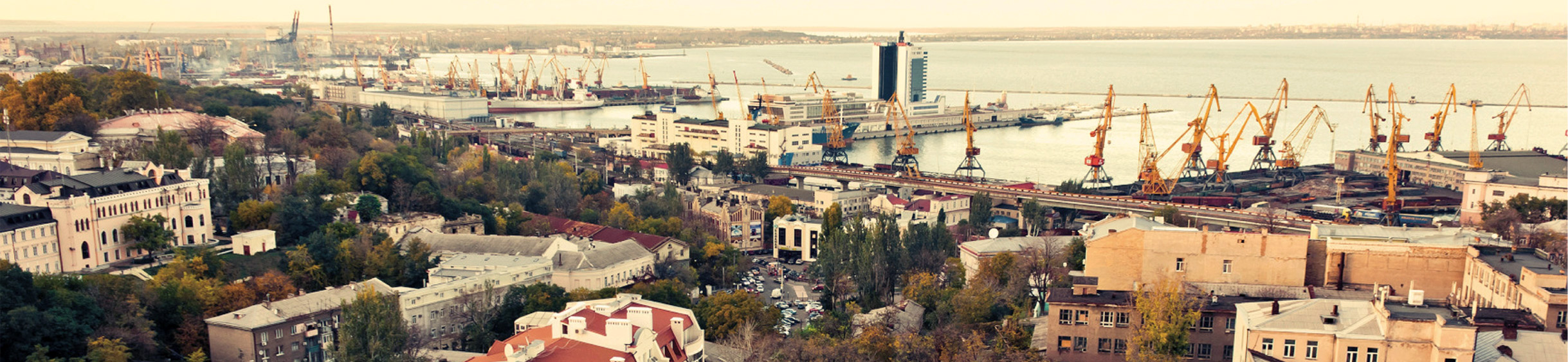
Kryvyi Rih is a rather interesting industrial city in Ukraine, stretching, according to the administrative boundaries from south to north for almost 67 km. Residential development, adjacent to large industrial facilities associated mainly with mining and heavy mechanical engineering, makes this city fairly unique. According to the 2020 census, the city has 660 thousand inhabitants, but the population of the conglomeration slightly exceeds 1 million. Long distances within the municipality, numerous people in the conglomeration, as well as pendulum migration associated with the presence of large industrial facilities located in the city, involves the use of rail transport as a way to cover significant distances.
Criticism
As one would expect, the former scale of industrial activity in the city, to which the inhabitants of the region are so accustomed, has subsided, and this is not surprising. The entire Soviet economy was built on populism, lies, dereliction and on the complete disregard of elementary principles and laws, one of which is the first law of thermodynamics, which says, in simple words, “energy can neither be created nor destroyed” (Same is with our money, huh). All the countries of the former Soviet Bloc are still being stifled by this grandiose carelessness, and Ukraine, unfortunately, is not an exception. Of course, all the above also applies to passenger transport.
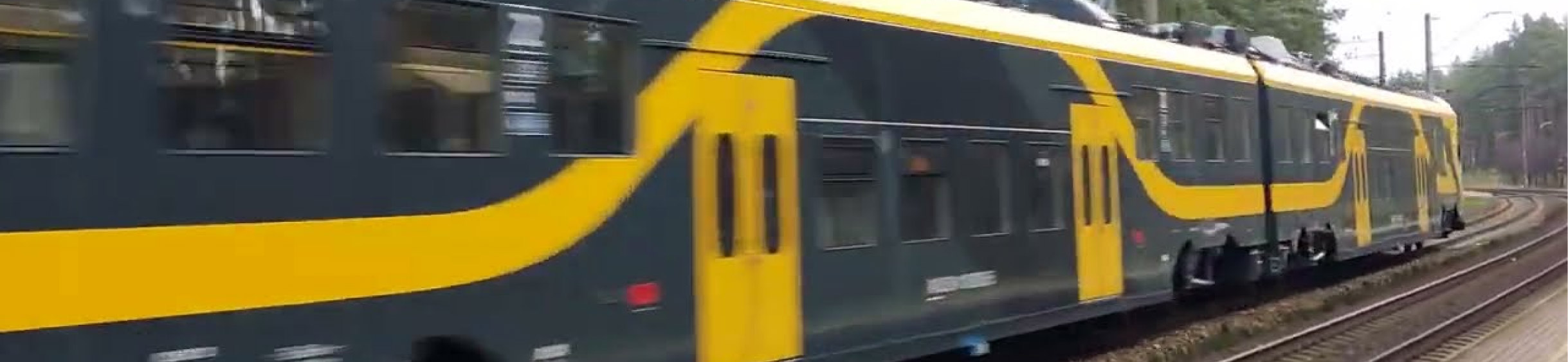
If you look at the local railroad, the train schedule is rather meagre, the train appearing on the stations is sporadic, based on the pendulum movement of passengers moving to and from their workplaces. Many lines are not used, and the rolling stock became obsolete 30 years ago or even more. The city has its own tram system and even a high-speed tram (Oh wow!) line, but its condition leaves much to be desired.
So what can we do? Let’s dream up!
Let’s start with the fact that the city is literally riddled with railway tracks, the vast majority of which are for industrial purposes as you can imagine. Nevertheless, the existing rail infrastructure can be partially used for the transportation of passengers. There are also less-used and even abandoned track segments, the restoration of which will require, by the way, much less funding than construction from scratch – this is a benefit!
Taking satellite maps and the existing track development as main tools, an excellent transport system can be sketched. Of course, do not forget that the feasibility of its creation also depends on funding, on the coverage of the territory, on the number of stations, and on the efficient train schedule. The frequency of train rides and regularity would be the key factor from the point of increasing the passenger flow if one of the goals is to set the service of the city.
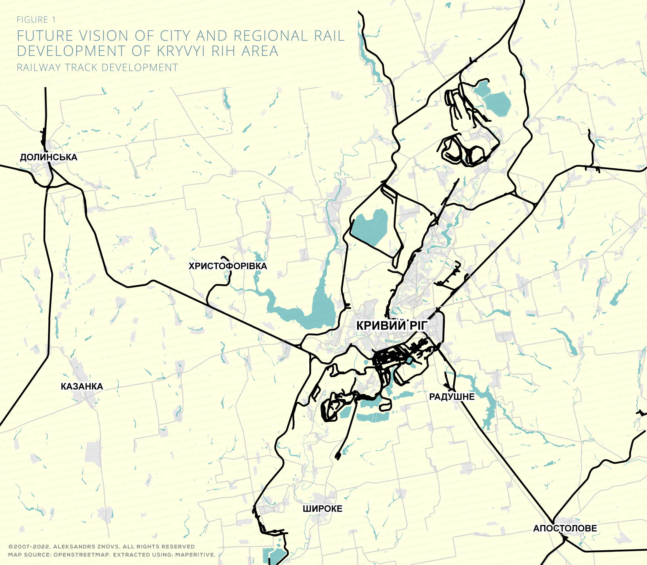
When I see such an abundant ramification of railroad tracks what Kryvyi Rih can be proud of (Figure 1), my eyes simply lightning up! Of course, most tracks cannot serve for passenger traffic, but to be honest, this is not so vitally necessary – in particular enough to use main trunk-lines to create a well-functioning transport system on this basis.
And now let’s look at Figure 2, where I sketched a possible version of the transport system. Oh, it seems many cities can feel envy of how train routes smoothly encircle the entire city. Yummy, isn’t it?!
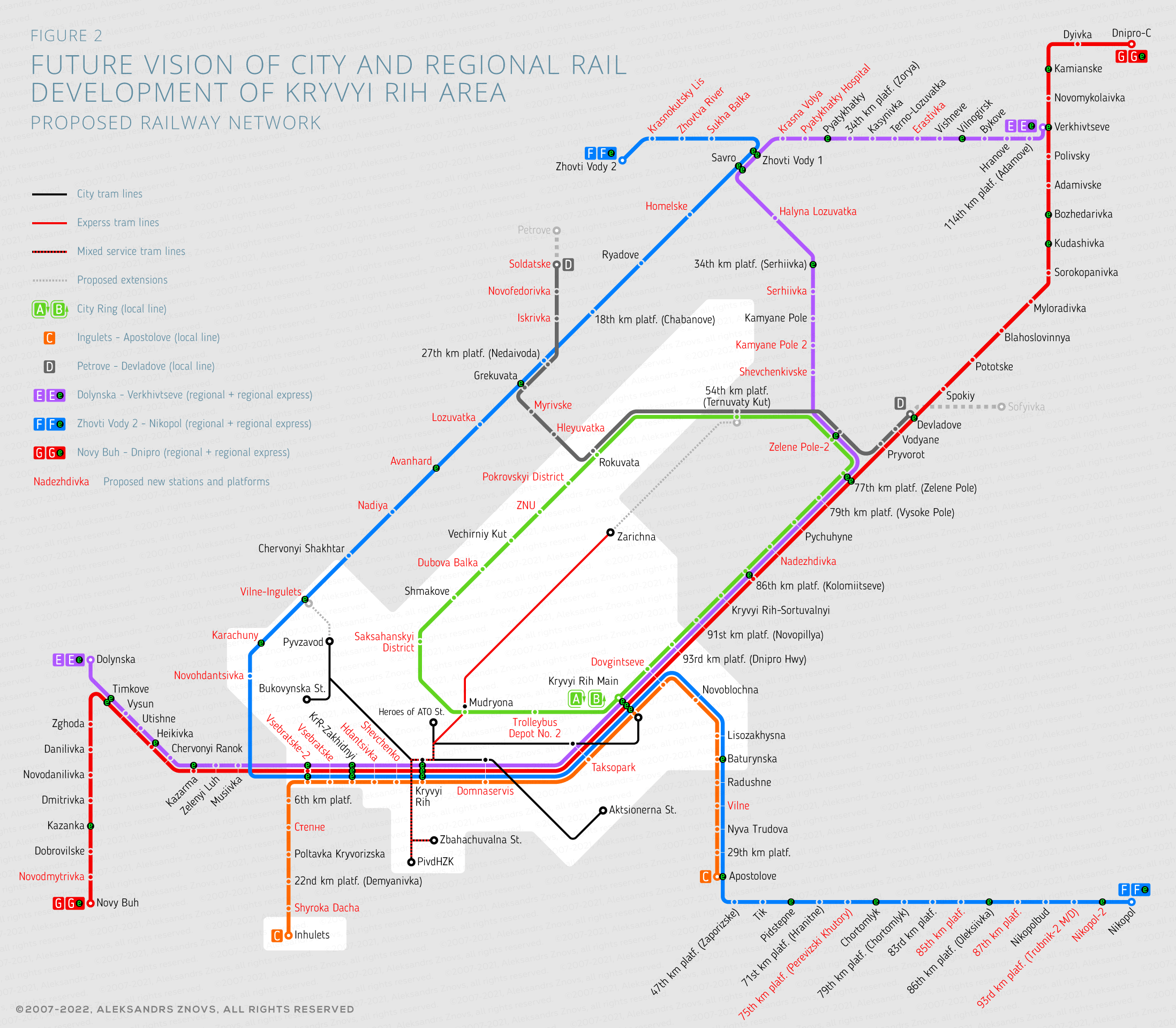
Briefly about lines
The city railway ring (Line A/B), in my opinion, can become the main transit corridor connecting the central station with most of the neighbourhoods. The horizontal diameter of the ring is about 22 km tall, and it is about 7 km wide. Densely populated city districts such as Pokrovsky, Saksagansky, Zarychny, Bozhedarivka and Yuvileiny are located between the left edge of the city ring and the high-speed tram line. Besides, the lower edge of the line passes through the densely populated Dovgivtseve district neighbouring with the main station. More, the Line is going along the upper edge of the city centre, where a transfer to a high-speed tram at Mudryona Station is possible. If we wish to use the line to the maximum, eight additional platforms along the line can be added, as well as maintain the proper traffic speed and reasonable train intervals will help this line to become a full-fledged city line.
Line C can easily claim the role of the second city line, which runs along the lower border of the centre, connecting the southern part of the city in a horizontal direction and passing through the residential areas of Vsebratske, Gdantsyvka, Chornogorka and having interchange stations to the Line A/B and other lines. Both ends of the line would connect the centre with the distant municipalities of Ingulets and Apostolovo.
The third city line could be Line D definitely will have fewer passenger flow, but it could become a convenient link between the city ring and other lines. Additionally, at the western end, it could be extended to the Petrove. It requires a 6 km long track extension what is a disputable decision, but this is the option. At the eastern end of the line from the termini station Devladove, it would be advisable to build a 9 km long single-track section to Sofyivka. This idea is also under question, but this is the option for the future again.
Lines E, F and G would connect the settlements of Dolynska, Zhovty Vody, Vehnivtseve and Novy Bug with the cities of Dnipro and Nikopol. All three lines conveniently intersect with the city ring line at the central station of Kryvyi Rih. All three mentioned lines are regional, with additional express services. For the passengers’ comfort, the lines would have a minimum stops in stations within the city borders where they are duplicated by local lines. Lines E and F, crossing each other, would create a second “ring” around Kryvyi Rih, passing mainly through suburban settlements.
As for the urban transport system, it would be advisable to think about extending the high-speed tram line to Ternuvaty Kut, giving residents of the northern part of the city easy access to the city ring line and Line D. An additional extension in the city tram system can be planned from the Pivzavod termini to a new station near the Vilne Village, which is in the south-west part of the city. It will give the inhabitants of Tsentralno-Myskyi District the additional access to the fast transit railway services, thus further relieving urban transport.
As we can see, the plan is quite ambitious, but do not forget that this is just a fantasy, but fantasies, as you know, always has a maximalism taste – a bunch of new stations, new infrastructure, modern trains… Life always makes its adjustments, painfully reveals the true value of our hopes, no matter how kind and sweet they are. Nevertheless, we should not forget that someday any kind of thoughts and ideas can serve as the beginning of real changes. Do not hesitate to dream for a good future, and have strong health in 2021! Cheers!
Title image credit: my-sokol.livejournal.com