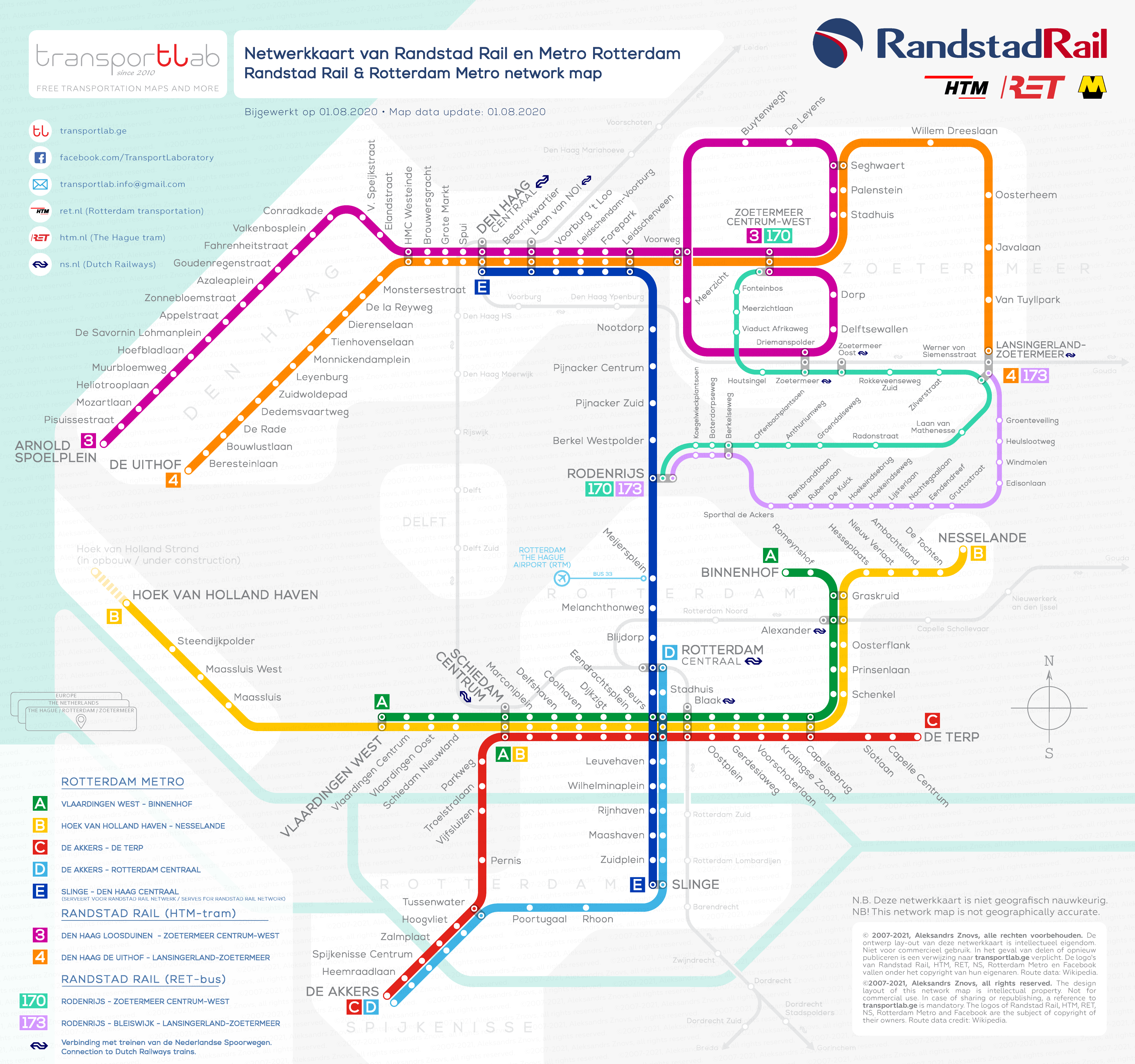
Randstad Rail is an ambitious interregional rapid transit project in the province of Zuid-Holland of the Netherlands linking the Rotterdam (with its one of the biggest seaports in the World) and The Hague – the political capital of the country. The network started its history in 1989 and became fully operational in 2010 except some later extensions.
As per 2020, the Randstad Rail network consists of two tram lines, one metro line and two bus lines. Both tramway lines connecting The Hague and nearby town Zoetermeer and served by The Hague municipal tramway company HSL. The metro line connects The Hague central railway station with the city of Rotterdam. Both bus lines are serving between the Meijersplein metro station and the town of Zoetermeer via Bergschenhoek and Bleiswijk. Both bus lines and metro line are under the responsibility of the Rotterdam municipal transportation authority RET.
The metro line gives easy access to the Rotterdam The Hague Airport (actually located in the Rotterdam) to the inhabitants of both cities and Zoetermeer town with short bus trip between Meijersplein metro station and the airport.
The purpose of this project was to create an alternative to rapid transit via motorways with more frequent stops than the classic railway services (i.e. Dutch Railways) can provide. So, if you wish to create something very comfortable and highly functional, let the metro from another city come to your streets and allow your trams to run in neighbouring towns!
Please enjoy whole Randstad Rail network on one compact map I am sharing with you for free. This network map is for non-commercial use only! To view or download a high-resolution map please click on the image below, then right-click and choose the action.


