I was supposed to draw a map of Swedish Railways is a quick job. When I started to collect all the data, I realized I was in a hurry with my conclusions. Nevertheless, the diagram is ready and let me hold a small intro for you.
Sweden is a fairly beautiful country located on the Scandinavian peninsula. It has a pretty extensive rail network, most of which serves passenger flow. The total length of railway lines exceeds 15,000 km, about 8,000 km of which have been electrified. Most inhabitants live in the southern part of the country. The same deal is with the density of railway lines.
The Kingdom of Sweden is located on a peninsula and has rail connections with most of its neighbours – with Denmark and further with the Central Europe by the Oresund Bridge. The border of Norway can be crossed in 4 points. Same Finland can be reached along the line that skirts the Gulf of Bothnia.
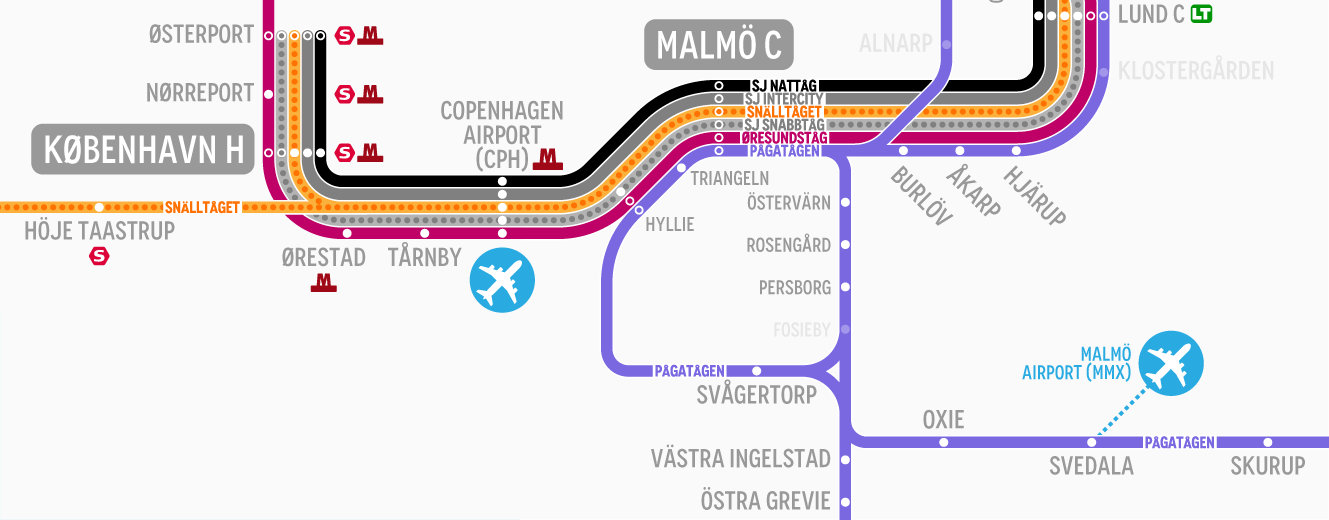
In recent years, various interstate and interregional projects have become very popular in Sweden, the purpose of which is to create convenient and financially efficient passenger transportation. One of such projects is The Øresund Railway Network, which covers the Greater Copenhagen Region in Denmark and the southern part of Sweden (Skåne or Scania Region and Västra Götaland Region).
For greater efficiency, The Swedish Railways (Statens Järnvägar or SJ – the national rail operator) offers various forms of management, partially allowing the privatization or leasing of entire railway lines and activities based on the principles of concession. All railway traffic is under the strict control of Trafikverket (The Swedish Transport Administration).
Honestly, while creating a general map I decided to add all companies which offer passenger services to date.
As a small bonus, I decided to add historical and museum railway lines, so railway fans could find new targets for their real and virtual tours.
According to recent information, which repeatedly appeared in the local and international media space the Parliament of Sweden has decided to start a new project to renovate the abandoned local railway lines, including narrow-gauge ones. This project begins next year and will be funded by the state, but the rest are offered by a European Union.
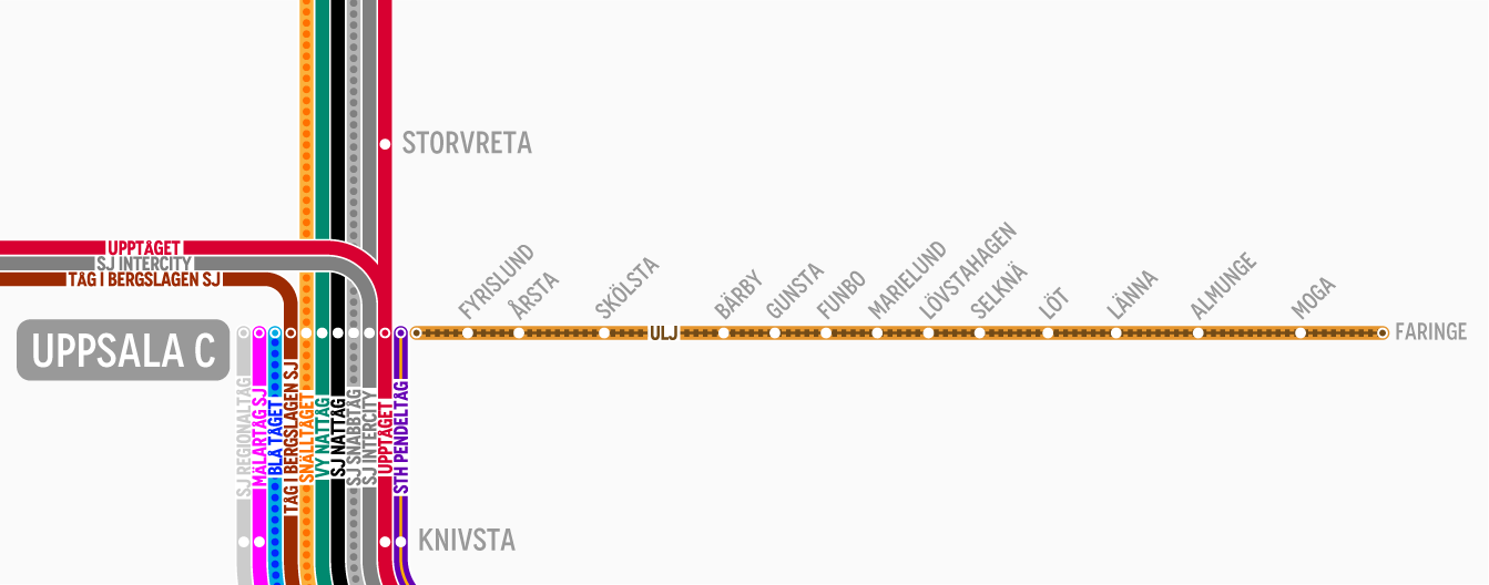
Okay, here is my version of the diagram, which, due to its large size and for your convenience, is divided into 2 parts – Northern and Southern (although even now the files are quite heavy). Additionally, it is possible to download a PDF version of the whole map with unlimited zoom quality.
Please visit and like my page on Facebook where you can contact me in case of any question or claim mistakes found on the network maps. Thanks.
Click on the links below to open the full resolution maps, which you can download to your device for free personal use.